


Breakstate
Outback track with a planned route drawn on paper
Expedition OS by Breakstate

You bring the route.
We find the risks.

The argument you should've had in the driveway.

Bring the route, vehicle, weather, fuel, equipment and recovery into one Plan.

Test the Plan before the Plan tests you.

You bring the route.
We find the risks.

Expedition OS by Breakstate

The argument you should've had in the driveway.

Bring the route, vehicle, weather, fuel, equipment and recovery into one Plan.

Test the Plan before the Plan tests you.

See what you get

Two legendary roads. Your Plan to take the one less traveled.

EXAMPLE PLAN, illustrative data

Alaska, US

Dalton Highway, Alaska

Fairbanks → Deadhorse via the Dalton Highway

Distance
About 500 mi
Travel days
6
Vehicle
BMW R 1300 GS, solo, soft luggage
  • HIGH RISK

    Coldfoot to Deadhorse fuel gap

    About 240 mi between fuel stops. Confirm available fuel and your loaded range.

  • HIGH RISK

    Wet gravel and passing trucks

    Wet calcium-chloride gravel can be slippery. Trucks throw rocks.

  • MEDIUM RISK

    Snow on Atigun Pass

    Snow is possible on Atigun Pass. Check conditions before committing.
Try this route

EXAMPLE PLAN, illustrative data

Western Australia, AU

Gibb River Road, Western Australia

Derby → Kununurra

Distance
About 660 km
Travel days
7
Vehicle
BMW R 1300 GS, two riders
  • HIGH RISK

    Pentecost River crossing

    Deep, rocky and in crocodile country. Check current crossing conditions before proceeding.

  • HIGH RISK

    Corrugations and bulldust

    Corrugations and bulldust demand careful speed, tire and load decisions.

  • MEDIUM RISK

    Dry season only

    Plan for the dry season and confirm road openings before departure.

Try this route
Or bring your own road.

Dehydrated in the outback. A clutch fixed with sandpaper and brake fluid on a Cape York beach while crocodiles watched. A stranger cut from a crashed car near Seward, Alaska. A three-hour wait for a ranger, 700 km from the nearest hospital.

Five minutes on this site might save your trip. Or your life.

Aaron Hudson, Founder

Read the full story

What you get

One place to work through the whole expedition.

Start with a destination, route or GPX file. Watch the expedition become a Plan you can use.

01

Build the journey

Map the route, dates, stages, fuel range and overnight stops.

02

Find what you missed

See where weather, distance, vehicle, load and recovery decisions collide.

03

Make it workable

Turn concerns into actions while you can still do something about them.

04

Keep the Plan

Save, download, share and keep editing for 3 months with an Expedition Pass.

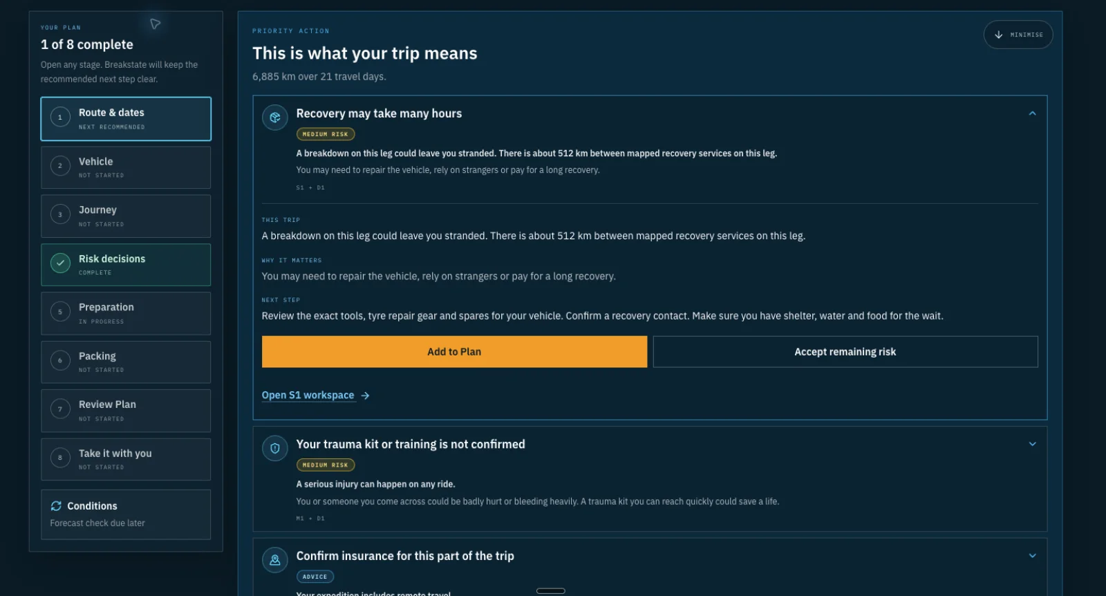
We find the risks

The problem is rarely one missing item.

A route can work. A fuel range can work. A load can work. Plans come apart where those decisions meet.

Expedition OS identifying recovery, trauma-kit and insurance risks

On four wheels? Same Plan, same risks found. Just more room for the fridge.
